Urdini lakes

Photo source: bg.wikipedia.org
Rila is one of the most beautiful mountains in our country, and the Seven Rila Lakes are the pearls in its crown. An indisputable fact. But the truth is that the mountain has hidden nearly 200 lakes, each of which is worth a visit.
In this line of thoughts, if you want to enjoy one of the most beautiful, but still not so popular lakes in Rila, we suggest you to choose the beautiful Urdini lakes.
Where is this lake group located?
The Urdini Lakes are located in the most inaccessible part of the Northwestern Rila and more precisely in the Urdin Circus, which is located between Damga Peak (2670 m) and Dodov Peak (2661 m).
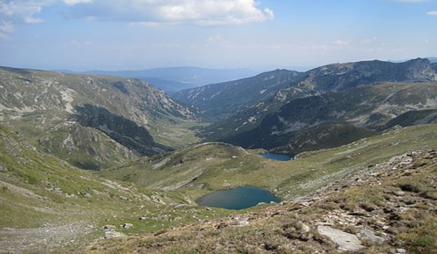
Photo source: bg.wikipedia.org
They represent a group of 6 lakes and bear the names: Triagalnika “Triangle”, Suhoto “The dry”, Udavnika “Drowning” (Botanical), Ribnoto “The fish”, Golyama Panitsa “Big Panitsa” and Malka Panitsa “Small Panitsa”.
The lakes are not located on a large area. The smallest one is Ribnoto (0.8 hectares) and the largest one is the Lake Golyamata Panitsa (about 2.5 hectares).
They are located at different heights and are distant from each other, but despite the distances between them, they are connected in a very curious way.
From each of the lakes there are streams flowing. They form a small waterfalls, which on the other hand, gather into one and give rise to the Urdina River – which is a right tributary of Cherni Iskar.
How to get there?
There are several routes, each of which has a different degree of complexity, so before the hike it is important to choose the most appropriate one, according to the physical form in which you are and the preparation that you have.
Malyovitsa CMS (central mountain school) – Yavorova Polyana – Urdina River Valley – Urdini Lakes – Malyovitsa CMS – 10 – 11 hours
This route starts a bit before the Malyovitsa CMS. In the direction of Govedartsi village, about 300 m from the parking of CMS, next to the road there is a tight trail that you should take. Use Google Maps to make sure that you won’t miss it. There the trail is marked as “Eco-trail Friends of Plants”.
The trail is marked in red markings (for Vada hut) and in blue – for Ivan Vazov hut, but since the trail does not branch anywhere on the way to Yavorova Polyana, there is no danger of getting confused or lost.
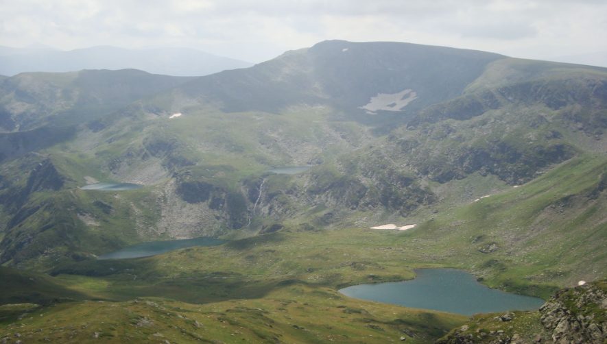
Photo source: bg.wikipedia.org
The path to the meadow has a low displacement and is very pleasant for a walk. When you reach the meadow, it is good to rest and gather strength, because you will need it.
A few hundred meters after the meadow you have to be careful. We are saying this, because the trail makes a sharp turn, crosses a bridge over the Urdina River, and there the markings disappear.
From this moment you have to use GPS or follow the river valley. After about 3-4 hours of walking and a lot of climbing you will reach a small shelter, which is the starting point of paths leading to all six lakes.
As mentioned above, the lakes are far apart, but they all can be explored in about 1-2 hours, even if you take some time to sit and rest around them.
After enjoying the beauty of the lakes and taking some time to relax, you can take the return trip.
Urdini Lakes across Zeleni rid – 11h
The route starts again from Malyovitsa CMS and to Yavorova Polyana is identical to the route described above.
When you reach the meadow, you must take the path with red markings, which leads to the Ivan Vazov hut and which will take you to “Zeleni Rid”.
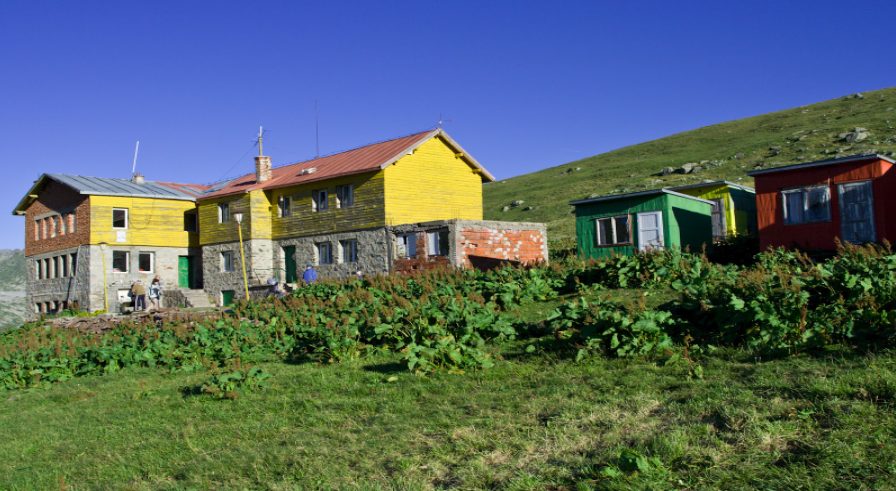
Photo source: bg.wikipedia.org
The distance from the meadow to “Zeleni rid” is not much, but with each step the displacement increases and it becomes more and more difficult to climb at your normal pace.
In about 30-40 minutes of hard but full of beautiful views climbing, you will reach Zeleni Rid and in front of you will shine not only the Urdin Lakes – in all its beauty, but also most of the Seven Rila Lakes in a distance.
First you will reach the Ribnovo Lake, where you can take a longer break. Then, with short hikes, you can tour the other lakes and enjoy them to the fullest.
On the way back to Yavorova Polyana at the beginning you will face a rather steep descent and you will cross several small streams. Gradually the path becomes a little flatter and pleasant to walk.
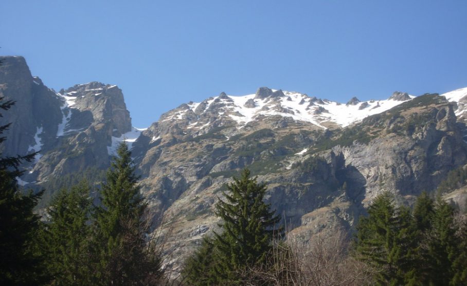
Photo source: bg.wikipedia.org
30-40 minutes of walking to Malyovitsa CMS – at a medium pace.
Malyovitsa hut – Malyovitsa peak – Urdini lakes through Yavorova polyana – 11h
This route is also not the easiest, but it is preferred by people who want to climb Malyovitsa peak and to enjoy the Urdin lakes at the same time. Or as they say “to kill two rabbits with one bullet”.
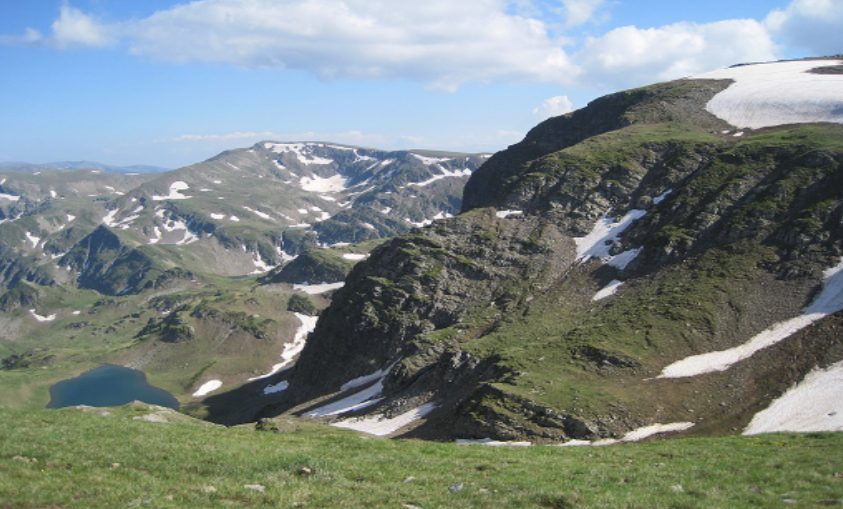
Photo source: bg.wikipedia.org
The hike begins as you can guess again from CSM Malyovitsa. There you have to leave your car and follow the path in blue markings, which leads to the Malyovitsa hut.
The distance to the hut is not much, and the trail is very pleasant for a walk, so it will hardly take you more than half an hour to reach it.
From the hut you have to take the path that leads to the First and Second Terraces. There, it may be a little harder for you, as the displacement becomes bigger and there are almost no trees along the way.
When you reach the Second Terrace you can relax a bit, then you should continue to one of the most beautiful lakes in Rila – Elenino Lake.
The time that will take you the reach the lake from the Second Terrace is about 45-50 minutes. Once you reach the shores of the lake, take a few minutes to enjoy the view. It is extremely beautiful and one of the most pleasant places for relax.
The peak is not far from Elenino Lake (about 30 – 40 minutes), but on the other hand, climbing in some places can be quite difficult.
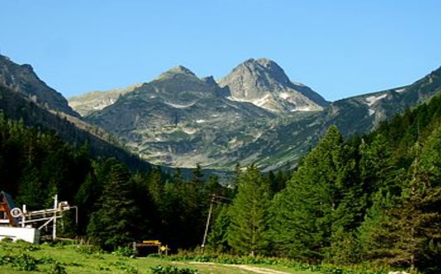
Photo source: bg.wikipedia.org
If you conquered the peak Malyovitsa successfully, you must continue, starting the descent on the other side.
After about half an hour of descent you will reach the fork that divides the trail into three – the trail on the left leads to the Rila Monastery, the middle one – to Ivan Vazov hut and the Seven Lakes, and the trail on the right to Urdini lakes.
The path to the lakes is unmarked, but it is quite crowded, so you can’t go wrong. After another 30 minutes of descent you will reach the first of the Urdin lakes, and after that it will take you about an hour to visit all the lakes of the lake group.
Once you are charged up with the beautiful views, you have to continue the descent from the last of the lakes Golyamata Panitsa to Yavorova Polyana, and once you get there, all you have to do is to reach the Malyovitsa CMS.