Elenino Lake
Източник снимка:bg.wikipedia.org
Ако обичате природата и мечтаете да се любувате на гледките на вековни гори, заснежени върхове и безкрайно сини езера, предлагаме ви да си подарите кратко пътешествие до едно от най-красивите езера у нас – Еленино езеро.
Къде се намира?
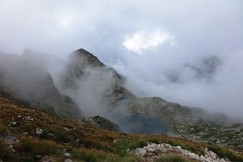
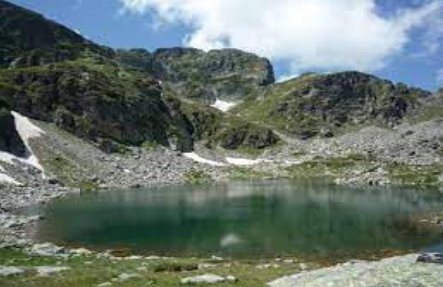
Еленино езеро се намира в Рила планина и е най-голямото от трите езера, които образуват езерна група, наречена Еленски езера.
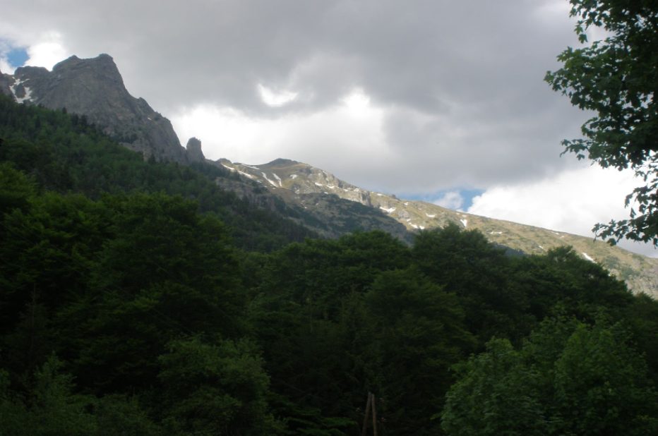
Разположено е на 2479 метра надморска височина, а във водите му се оглеждат четири от най-красивите върхове в Рила – Орловец, Мальовица, Попова капа и Голям Купен.
Като размери, езерото трудно може да се нареди сред най-големите езера в планината, но с дължината си от 220 метра, широчина от 62 метра и дълбочина, достигаща до 5 метра е най-голямото и най-красивото от трите Еленски езера.
Формата му е леко удължена и неправилна, а бреговете му се каменисти. Подхранва се основно от топящите се снегове.
Източник снимка:bg.wikipedia.org
Легенда за езерото
Както почти всички природни забележителности, и Еленино езеро има своята красива и много романтична легенда. Според нея, преди много години, по време на турското робство в Самоков живеела чудно красива мома на име Елена.
Един ден в града дошъл на гости турския паша Селим, който видял Елена и поискал от жителите на Самоков да му я продадат, ако не искат да им вземе имотите.
Събрали се първенците и не умували много, а продали момата на Селим паша. По пътя обаче Елена успяла да избяга в планината, където я среща четата на Мальо Войвода и момата станала част от неговата дружина.
Годините минавали, девойката се превърнала в един от най-добрите стрелци на четата и не пропускала сражение с турските отряди.
Водена от желанието си за мъст, Елена не си позволява да има чувства, но на сърцето трудно се заповяда и тя се влюбила в байрактаря на дружината.
Въпреки, че го обичала с цялото си сърце девойката, не му признала чувствата си, защото смятала, че отмъщението е по-важно от любовта.
Източник снимка: bg.wikipedia.org
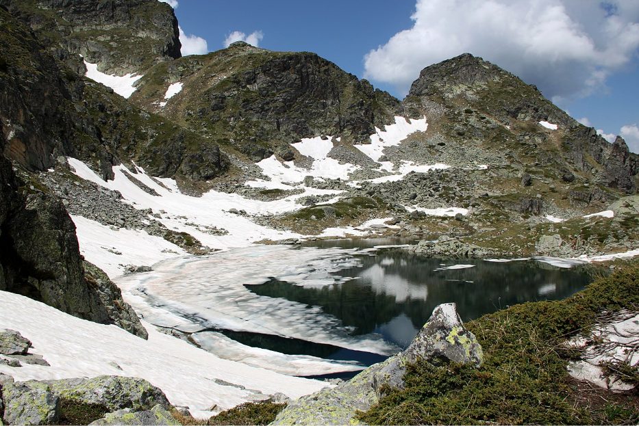
И ето че един ден Елена най-сетне успяла да открие Селим паша и да му отмъсти. Убила турчина с един точен изстрел, но за нещастие при престрелката и тя сама била тежко ранена.
Нейните другари, виждайки, че девойката да става все по-слаба и няма да оцелее я отнесли високо в планината и я положили на брега на едно от най-красивите и бистри езера.
С последни сили Елена най-сетне признала любовта си на любимия и осъзнала, че заради отмъщението е изгубила най-важното и ценното в живота – любовта си.
След като издъхнала другарите ѝ я погребали на брега на езерото, а то от тогава до днес носи нейното име – Еленино езеро.
Източник снимка: luckybansko.bg
Как се стига до там?
Тъй като езерото се намира на пътя на туристическия маршрут за изкачване на връх Мальовица единственият начин да достигнете до него е като поемете и вие по маршрута.
Маршрут ЦПШ “Мальовица” – връх Мальовица
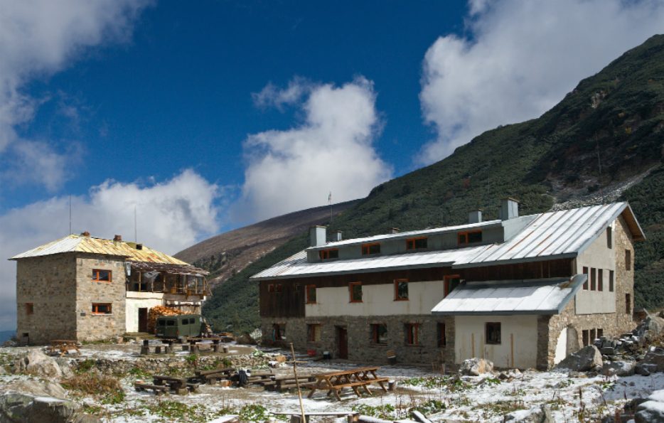
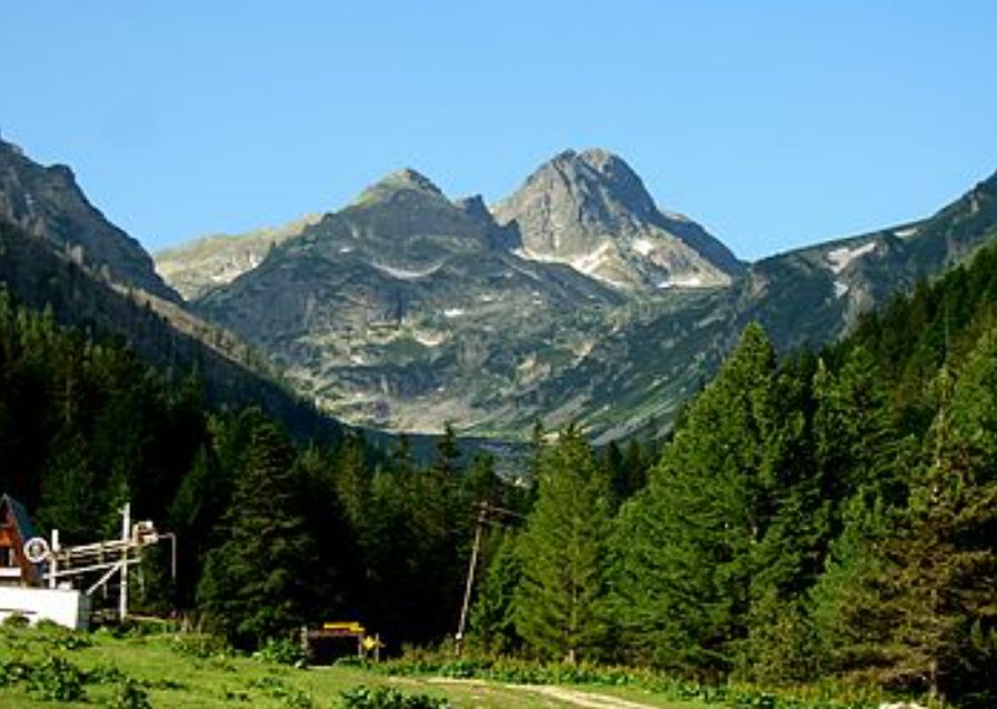
Маршрутът започва от ЦПШ “Мальовица” в местността Меча Поляна (на около 20 км от Самоков).
До местността можете да стигнете с автомобил, който обаче трябва да оставите на паркинга пред Централната Планинска Школа “Мальовица” и да поемете пеш по пътеката.
Източник снимка:bg.wikipedia.org
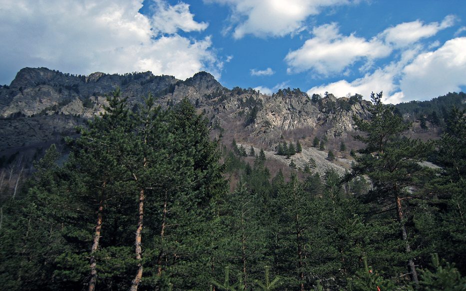
Етап 1 – ЦПШ “Мальовица” – хижа Мальовица
Разстоянието от ЦПШ до хижата при средно темпо и без голяма нужда от почивки се изминава за около 35 – 40 минути.
Пътеката, по която трябва да вървите е със синя маркировка и няма разклонения, така че няма къде да се объркате.
Този етап на маршрута е с ниска степен на трудност и със сравнително малък наклон, така че и дори и да не сте от най-добре подготвените планинари едва ли ще ви затрудни особено.
Източник снимка: bg.wikipedia.org
Етап 2 – хижа Мальовица – Първа и Втора тераса
Стигнете ли до хижата е добре да хапнете, да отморите и най-вече да не забравите да се заредите с вода, тъй като нагоре започва стръмното, а вода няма къде да си налеете.
След хижа Мальовица трябва да следвате пътеката с маркировка бяло – синьо. Изкачването става по-трудно, тъй като растителността постепенно намалява, а денивелацията се увеличава малко по малко.
Около половин час след хижата ще стигнете до първата тераса от трасето, където можете да си направите отново една кратка почивка, за да си отдъхнете и да се насладите на гледките, които се разкриват пред очите ви.
Изкачването продължава към Втора тераса. Пътеката, която трябва да следвате вече е с червена маркировка, но дори и да не обръщате много внимание, няма как да се объркате, тъй като това е единствената пътека, която води към Мальовица. Трасето до Втората тераса е с приемлив наклон, но пътеката става все по-камениста, а растителност почти липсва.
Ще познаете, че сте минали Втората тераса, когато видите голяма скала, върху която са поставени паметни плочи. (Паметните плочи за български алпинисти, загинали при изкачване на родни и чужди върхове).
Източник снимка: bg.wikipedia.org
Етап 3 – Втора тераса – Еленино езеро
Ако решите да достигнете само до Еленино езеро и да не завършите изкачването на връх Мальовица, остава ви още съвсем малко преход.
От Втората тераса до Еленино езеро ще достигнете за около час, ако вървите със средно темпо. Тук трябва да сте по-внимателни, тъй като денивелацията е доста голяма, пътеката е изключително камениста, а има и няколко супер стръмни места и ако не внимавате може да се подхлъзнете.
Но успеете ли да се справите уверяваме ви, в мига, в който зърнете красивото езеро ще забравите изтощението и умората.
Източник снимка:wikimapia.org
Ако след общо 3 – часовия преход до езерото имате сили и решите да положите още малко усилия и да покорите върха, ви остава да преодолеете само още един етап от маршрута.
Етап 4 – Еленино езеро – връх Мальовица
В началото изкачването към върха е доста тежко, тъй като теренът е с голяма денивелация и е много каменист. За радост стръмното е малко и след като го преодолеете ще се движите по билото на планината, където теренът е равен, а гледките – невероятни.
Източник снимка:bg.wikipedia.org
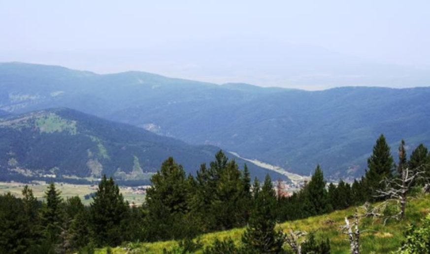
Ако се обърнете и погледнете назад, ще видите цялата езерна група Еленски езера, а ако погледнете към долината на юг в далечината ще видите Рилския манастир.
След около още 30 минути изкачване със средна степен на трудност ще стигнете до крайната си цел, а именно – връх Мальовица. Пред вас ще се открие невероятна гледка към връх Мусала, към Рибните езера, а ако е слънчево и ясно можете да видите в далечината Пирин и дори Витоша.