Path to the kingdom of edelweiss
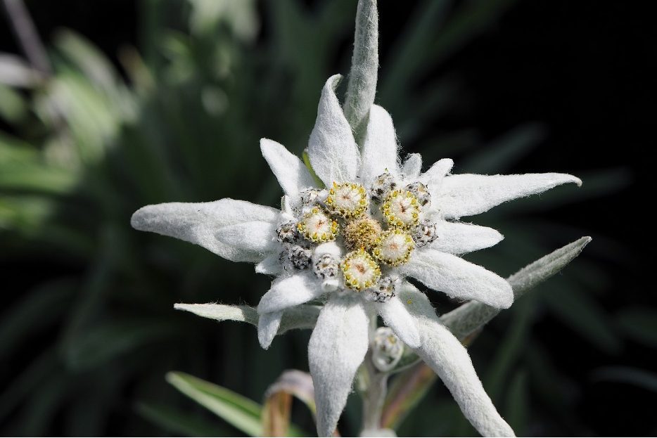
Photo source: bg.wikipedia.org
Do you like hiking in the mountains, but do not feel prepared for long and strenuous hikes? Or are you with small children and looking for a not very busy tourist route that the whole family can take?
If you are in the region of Bansko or Razlog and you want to spend a really great day in the mountains, we suggest you take the eco-trail “To the kingdom of edelweiss”.
General information about the tourist route
The eco-trail was officially built in 2007 and is a joint project between Razlog Municipality and Pirin National Park.
The route has a total length of 16 kilometers and runs on an old forest road that leads to Yavorov hut.
The route has a displacement of 990 meters, the difficulty of which is from medium to high, and the time you will need to get from the starting point to Yavorov hut is about 3-4 hours.
The eco-trail is very well marked, has separate viewing platforms and places for rest. It is suitable for both hiking and biking.
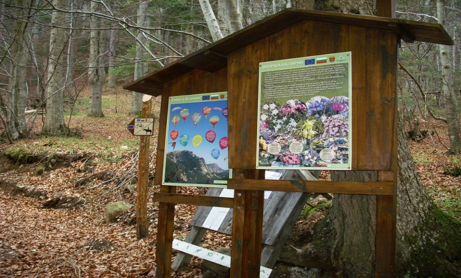
Photo source: pochivka.bg
From Betolovoto area to Yavorov hut – a pleasant walk in the nature
The eco-trail starts from the Betolovoto area, which is located above the town of Razlog.
To get to it you have to take the road from Bansko – Simitli and just follow the signs.
Once you arrive, before taking the path to “the kingdom of edelweiss” you can see the nearby remains of medieval churches.
The “Written Church” and the medieval churches “St. Nicholas” and “White Church” are located in the area. The archaeological sites are still being explored, but it’s worth taking some time to view them.
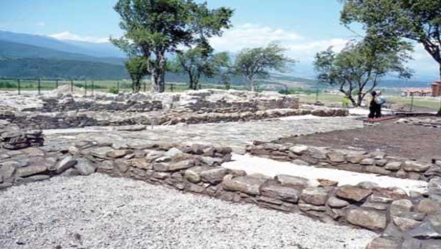
Photo source: wikimapia.org
After visiting the archeological park in the area, you should find the path that leads to the hut. It is well marked (in yellow markings), and for greater attractiveness, its creators have placed bear paws all the way to indicate the direction in which you should go.
The route of the trail passes through the Control and Information Point of Pirin National Park, where you will see a bear’s lair and an eagle’s nest (the eagle is a symbol of the Pirin Mountain).
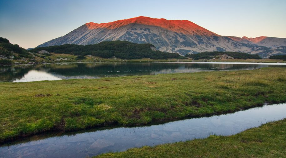
Photo source: bg.wikipedia.org
Then the forest road will take you to an extremely pleasant place for relaxation, where you can relax and enjoy the beautiful views that are revealed both to the Razlog valley and to Rila and Pirin.
Along the entire route you will encounter bizarre rock formations, lush waterfalls and beautiful water cascades, you will pass through centuries-old forests and vast meadows. You will enjoy the aroma of mountain herbs and flowers and if you have a good luck you can even meet some well-meaning forest dweller.
And as you cross the trail, you will see informational and educational boards in many places along the trail, from which you can learn more about the fauna and flora of the area. Of course, special attention is paid to edelweiss – one of the most beautiful and rare mountain flowers that grow in our area.
The last “stop” before you reach the end point of the route is Varnitsata, where there are separate places for rest and relaxation.
While relaxing and enjoying the beautiful views of Rila and Pirin, you can see the educational boards placed near the recreation areas, which provide extremely interesting and rich information about the biodiversity of Pirin National Park.
The final point of the route is Yavorov hut, where you can eat something tasty and relax well before heading back down to the town of Razlog.
And if you do not feel like going all the way back, you can spend the night in the hut and on the next day you can take one of the many routes that starts from here.
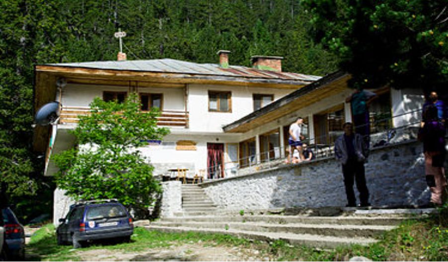
Photo source: bg.wikipedia.org
Popular hiking trails that start from Yavorov hut
Yavorov hut – Bayuvi Dupki peak
The route is 6 km long in the direction, its difficulty is high, and the duration is 4-5 hours.
The trail starts above Yavorov hut, and the markings to be followed are two – red and yellow.
The route goes through a forest, then passes through the Bunker shelter and about two hours you have to reach Suhindol Lake.
The lake is not only very beautiful, but it is also the last place where you can fill up with water before continuing.
From the lake begins the ascent of the Okaden hill. Here you have to follow the red marking that leads to the Koncheto shelter.
The ascent is steep and dangerous in some places. It goes along the ridge of the Karst edge. Then the trail crosses Razlozhki Suhodol peak and leads to the place where the ascent to Bayuvi Dupki peak begins.
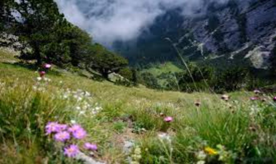
Photo source: luckybansko.bg
The return can be either on the way back or continue to Vihren hut. It is also possible to reach the Banski Suhodol peak, and from there to the Banderitsa hut and descend to Bansko.
This transition is quite difficult, so if you do not have very good preparation, we advise you to skip it.
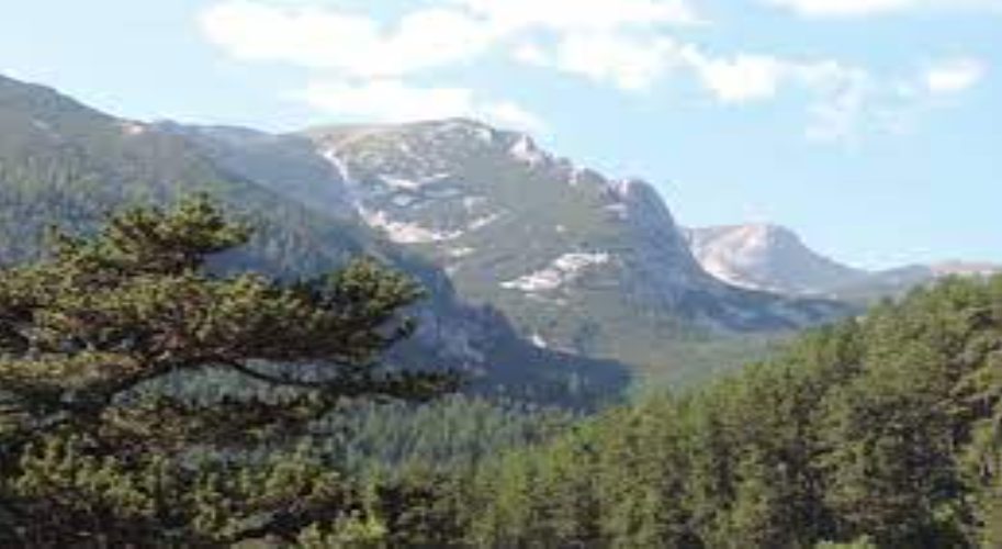
Photo source: bg.wikipedia.org
Yavorov hut – karst edge Koncheto
This route is 8 kilometers long in one direction, its difficulty is high, and its duration is about 5.3 – 6 hours.
The trail starts above Yavorov hut and the ascent is initially quite pleasant and unburdening. However, the slope becomes a little smaller and the ascent becomes more difficult.
Somewhere in the middle of the road you reach the Bunker shelter and shortly after it, you reach the Suhindol Lake, where you have to fill up with water and have a good rest.
After the lake, the slope of the trail becomes even bigger and the ascent more difficult. But as soon as you reach the Suhodol pass, you will forget all your troubles, because in front of you will be revealed an incredible view of the karst ridge of Pirin.
Once you enjoy the view and calm your breath a bit, you should continue your trek along the mountain ridge.
The route passes under the peak Bayuvi Dupki and goes to the shelter Koncheto.
After the shelter you continue to climb for another 15-20 minutes, until you reach the peak of Banski Suhodol, from which the karst edge Koncheto starts.
A real challenge awaits you here. The karst edge is about 400 meters long and in places its width reaches only half a meter.
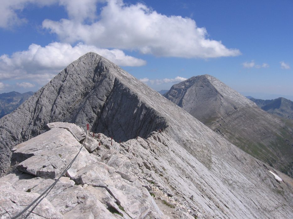
Photo source: bg.wikipedia.org
To pass through it you have to hold on to the safety ropes. And yes, it’s scary to move on the edge, but it’s really worth the effort.
If you go through the Koncheto, you have several options. You can go down to Vihren hut through Vihren peak, return to Yavorov hut through the Bayuva Dupka circus or go down to Banderitsa hut.
Needless to say, this route is also quite difficult and it is not advisable to take the transition if you do not have good physical preparation.
Yavorov hut – Bayuvi Dupki peak through the circus Bayuvi Dupki
The length of this route is 7.5 kilometers, the difficulty is medium and its duration is about 4-5 hours.
The route starts east of Yavorov hut, in the direction of Yavorova Polyana. The markings you have to follow are green, but in some places they are missing, so don’t rely on them, too much.
If you reach Yavorova Polyana you have to continue and about a kilometer you will reach a large meadow, from which starts a narrow path that leads to the Kamenitishki pass.
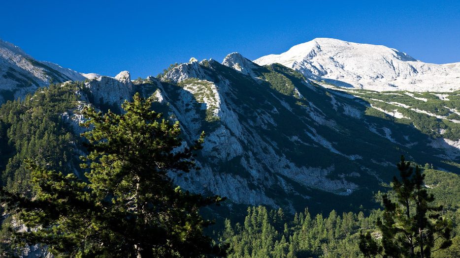
Photo source: bg.wikipedia.org
At first the trail is very pleasant, but then the slope becomes bigger. The route passes through the Pogledets area and enters a forest. After a while the forest thins and shortly after that the approach to Sabite begins.
As soon as you climb the ridge of Sabite, the trail will flow into the trail with red markings, which leads from Yavorov hut to Vihren hut. Here you have to be careful, because you don’t have to walk over the trail, but take the path that is on the left, because it will take you straight to the top.