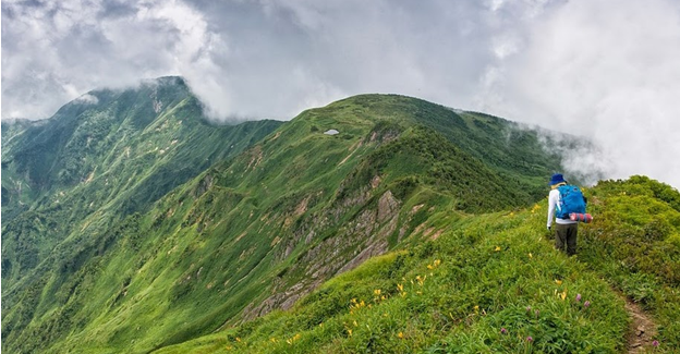
You love the mountains and are considering hiking to one of the peaks of Rila, Vitosha, Pirin or StaraPlanina. Or you want to go on a hiking trail on your own, which you have just discovered and which you find very interesting.
Undoubtedly, the adventure on the mountain trails can be extremely exciting, interesting and energizing. But it can also be dangerous. Especially if you are considering navigating the route alone and are not well prepared for all the challenges that await you.
How to prepare for a walk or hike in the mountainswhen you are alone?
Route selection
Choose a route suitable for your physical training. Carefully examine the route you want to take. Gather all available information about it and read it carefully.
Pay special attention to the difficulty of the route and the round trip. Assess whether you are really well prepared enough to handle both the displacement and the length of the rout.
Weather forecast
The weather in the high parts of the mountain changes in seconds. Therefore, before setting off on the selected route, you must have accurate forecast data. Today there are enough sites that provide reliable weather information in all regions of the country(including the metrological conditions in the highlands in the mountains).
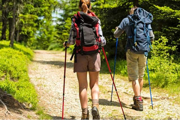
Equipment (clothing, backpack)
As mentioned, the conditions in the mountains change very quickly and it is highly recommended to equip yourself well for the whims of the mountains.
Clothing
Clothing should be able to provide you with the necessary comfort and protect you from cold, wind, rain and snow. Experts recommend wearing sturdy and comfortable hiking boots and dressing for the mountains like an “onion”.
This means having several layers of clothing that you can easily put on and take off. It is also recommended that your clothes are comfortable, light and breathable, but also that they can effectively protect you from wind and rain.
Backpack
The backpack should be large enough (from 25 liters upwards) to accommodate clothes you are not currently wearing and equipment.
There should also be space for the following:
- Windproof jacket
- Sun hat, spare set of clothes
- Sunscreen
- First aid kit
- Food
- Water
- Camera
- Sun glasses
- Flashlight
- Charged phone
Equipment
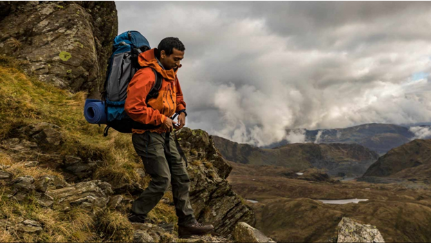
If you are driving on the route alone and without a guide, the navigation equipment is extremely important. It can help you get back on the trail if you go out of it or find the road and go back to the nearest town. The equipment includes:
- Topographic map of the area, compass, altimeter, GPS or other
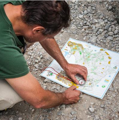
How to navigate a map in the mountains?
As we have just emphasized, the ability to navigate a map in the mountains is very important for your safety, so you need to know how to manage this equipment.
Unfold the map and look at it
Explore the topographic map. Pay attention to the contour lines (each line represents the same code along its length). If you see, for example, many contour lines gathered in one place, it means that the elevation changes and becomes steep. If you see small circles in each other, it means that there is a peak nearby.
Pay attention to the scale
For example, if the scale is 1:50000, this means that every centimeter of the map corresponds to 500 meters in reality. If it has a scale of 1: 25000, this corresponds to 250 meters in fact, etc., and so.
Take a look at the legend
Each card has a legend that describes what the symbols marked on it mean. More importantly, however, this is where you will find the magnetic declination of the area, which will be useful if you have a compass. The legend also defines other sites such as stations, natural landmarks, huts (if any), rivers, waterfalls and others that can serve as a guide.
Find your location
To find out exactly where you are, it is good to get to a more noticeable place (peak, waterfall, mound, bridge, landmark, watershed, etc.). Stay there, open the topographic map and find on it the symbol of the natural landmark you are next to.
Find the right direction with the map and compass
Once you find your exact location, you need to work with the map and compass to find the right direction. To do this, you must check the map. This means placing the compass on the meridian and rotating the map so that the magnetic needle of the compass coincides with the north direction.Once you fix the declination of the compass, it will point to the true, not the magnetic north, and you’re ready to use the map to orient yourself. Hold the map and compass in your hands to make sure you are moving in the right direction. If you feel you are losing direction, rediscover a noticeable spot to find your exact location and adjust your movement if necessary.
How to act in unexpected situations?
We don’t wish it on you, but it is quite possible that you will get lost in the mountains and not be able to find the right direction. If you find yourself in such unforeseen situations, you must remain calm and act wisely and purposefully.
Orient yourself on the Sun.
If you do not have a map, compass or GPS, use the Sun as a guide. If it is bright, remove the analog clock from your hand, place it on a level surface and point its clockwise in the direction of the Sun. Divide the angle formed between the clock hand and the mark 12 into two equal parts. This way you will find out where the line “north” – “south” is.
Observe the nature around you
Examine the trees. You will notice that their branches are better developed and the leaves are greener on one side. This country is always in a “south” direction.
If there are felled trees nearby, their rings will be slightly stretched again in a “south” direction. You will find out where the north is by paying attention to where there is the most moss on the trees.
Use the stars as a guide
If it gets dark in the forest, look at the starry sky and find the North Star. You will find it near the constellation The Big Bear (this constellation looks like a ladle).
If you find the “ladle”, mentally draw a line that starts from the two stars at the bottom of the constellation and you will find a star that shines quite brightly. This star is the North Star and always points to “north”. She is also the only one who does not move in the night sky like the other stars.
Use the method Shadow and Stick
Find a flat, sunny place and drive a stick into the ground. Notice where the end of the shadow of the stick is and place a stone (the stone acts as a marker and shows “west”). Wait 20-30 minutes and place a new marker on the end of the shadow of the stick (the shadow will have already shifted). This marker shows “east”.
Draw a line to connect “east” and “west”. Once you have the line “east” – “west” it “halves” and you will find where “north” – “south”. The only disadvantage of this method is that it will take you a long time to determine the directions.
Other navigation techniques for orientation
It has been proven that we humans, if we do not follow a precise landmark or if we do not follow a path, after a while we start turning in a circle. And this is not due to our ignorance or stupidity, but simply because our left step is a little bigger than our right. So when we walk through the forest it seems to us that we are walking in a straight line, but we are actually turning and walking in a circle.
To prevent this from happening, you need to make sure you are heading north to make sure you are going in a straight line. Instead of constantly checking, you can alternatively use the following navigation technique:
- Stand still and find the direction “north” (we have already said how).
- Draw a line on the ground in this direction (or in the direction you are moving).
- Use the line you just drew to find a landmark forward and in the same direction. The landmark should be easily visible as you walk towards it.
- Go to the landmark.
- When you get there, repeat the exercise with the stick to the next landmark.
- Keep doing this until you return to the road, reach your final destination, or find a nearby town.
If you get lost during the transition and worry too much to look for where “north” is, go down, not up the mountain. Many of the more inexperienced mountaineers, in an attempt to reach a place with a better view of the surroundings, climb high and get even more confused.
You go down because the chance of getting on a railroad, road or town is much higher. You know that most settlements are located at the foothill of the mountains.
If nothing else works, walk until you find a stream or river. If you find it, walk parallel to the river, following the direction in which the water flows.
You know that the rivers spring high in the mountains, but go down to the settlements. So, if you follow the river you will reach a bridge, a road, a building or a settlement.
Keep in mind, however, that this way of orientation can only be useful if you are in a smaller natural area. If you are in a vast area like Alaska, for example, this method is unlikely to work effectively.
Last but not least
Always carry a fully charged phone with you and contact your local mountain rescue service before heading to the mountains alone. Let them know that you plan to make the transition and write down their phone numbers. So, if everything goes wrong and you don’t think you can handle it, just contact the mountain rescuers and follow their instructions.